Michael has provided teacher-training through Nebraska BLAST! for the past several years. He had a workshop this week that included a high-altitude ballooning launch.
The following images are from the GoPro2 camera during the flight. Nebraska BLAST! teachers, feel free to download these photos and use them in presentations or to show your administration or share with your students.
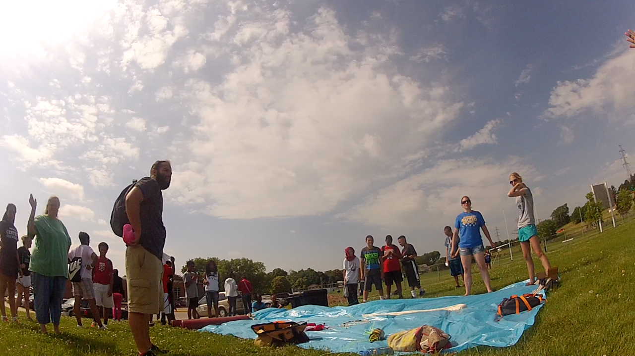
Preparing to launch
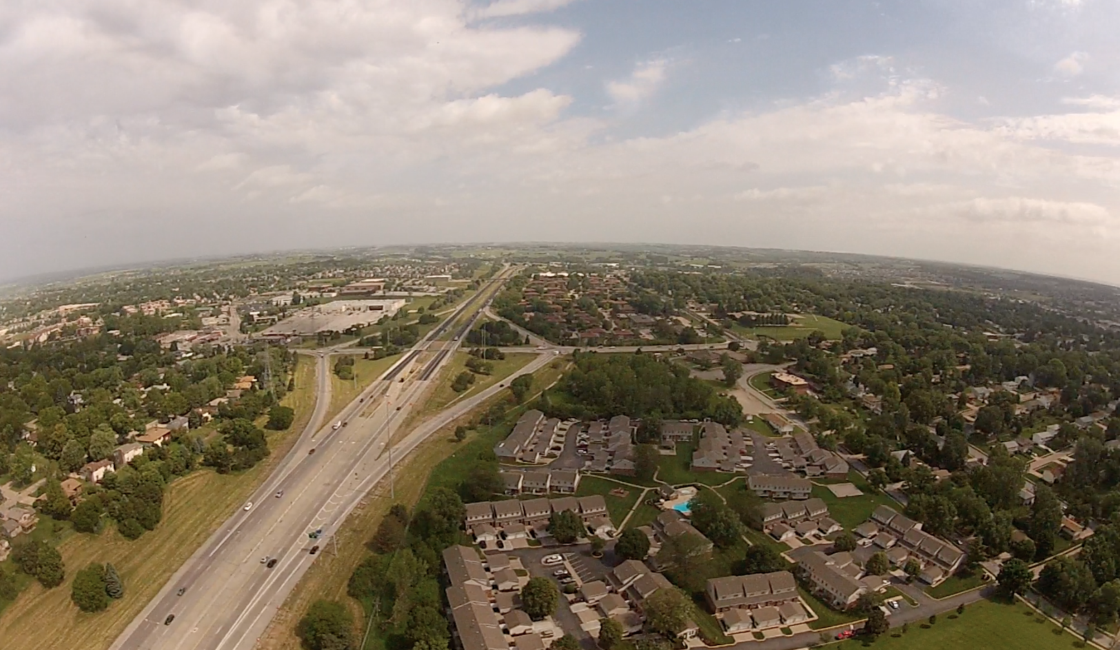
Looking over I-680 in Omaha
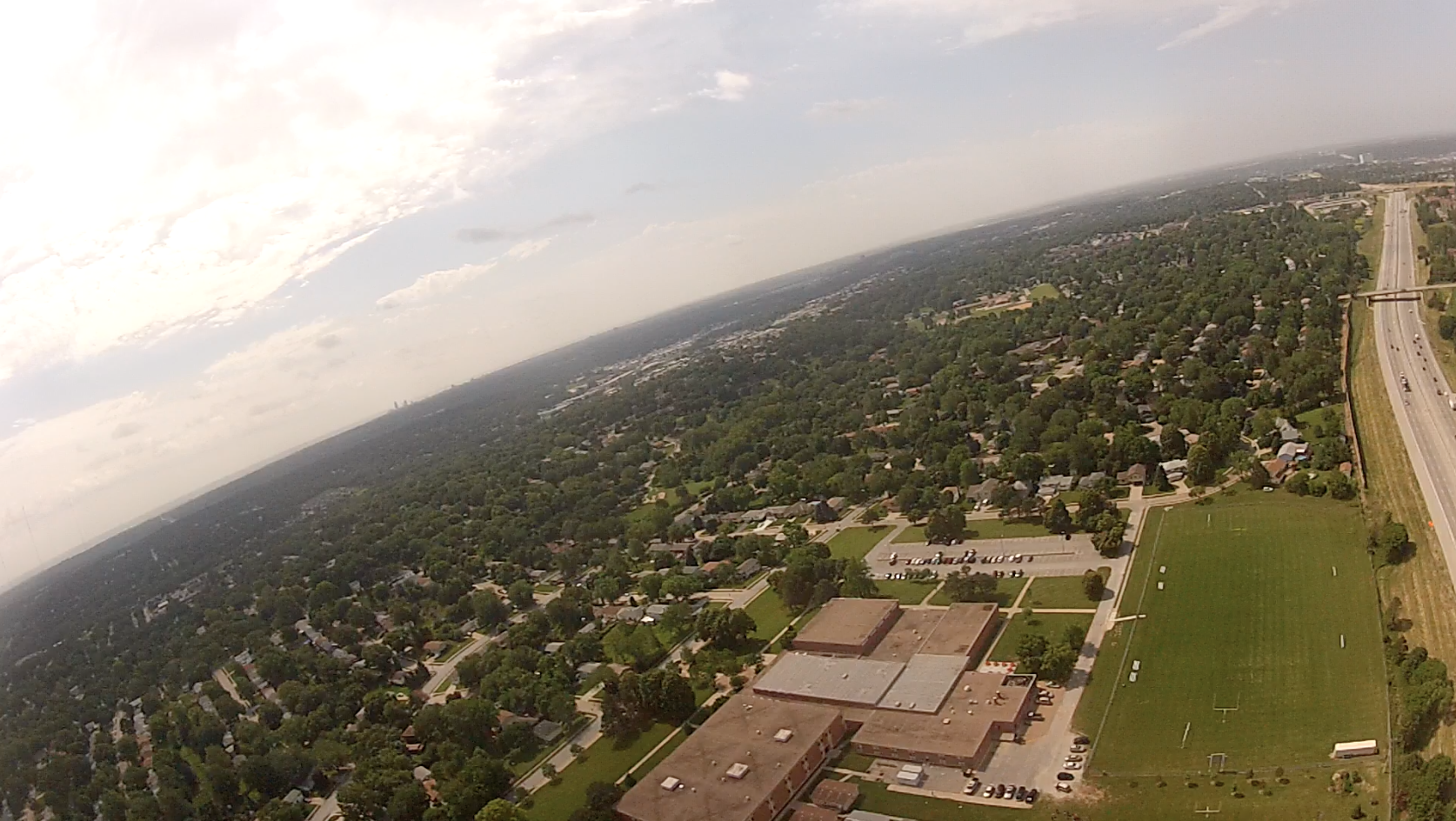
Morton Middle School launch location
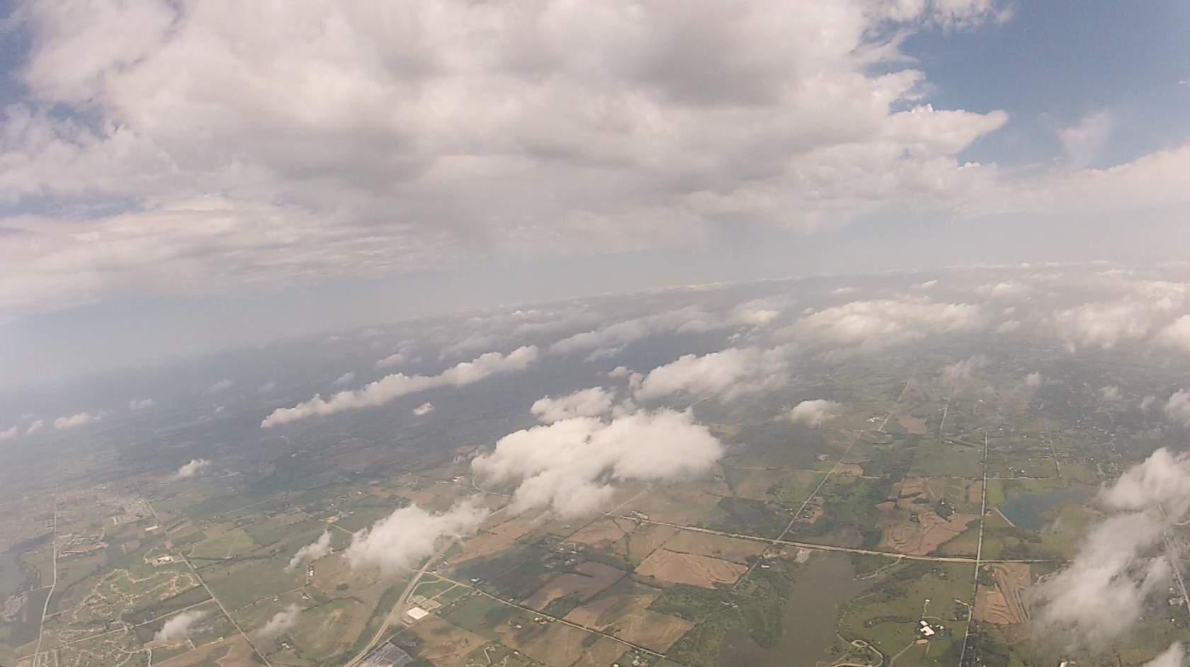
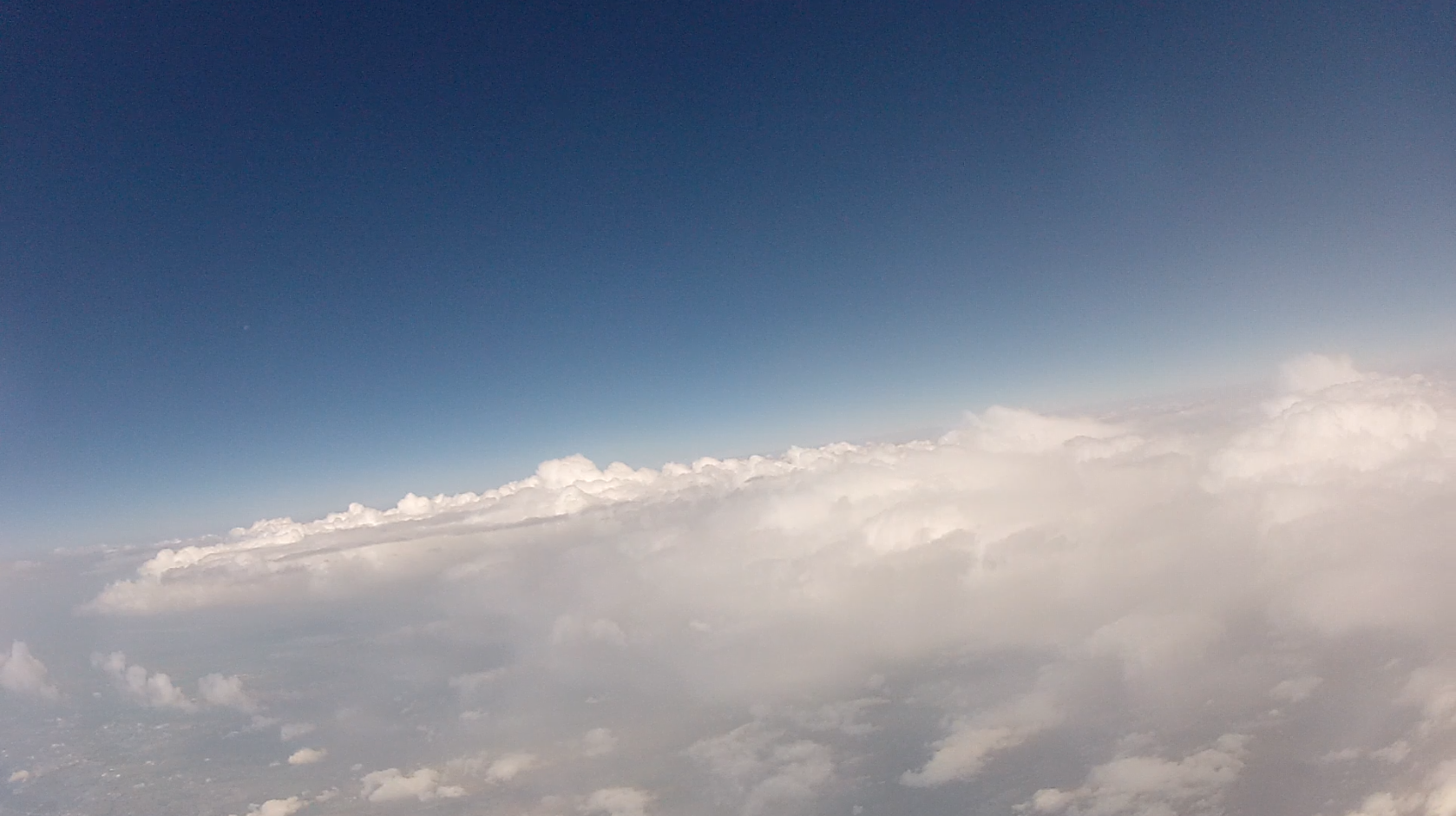
Between cloud layers
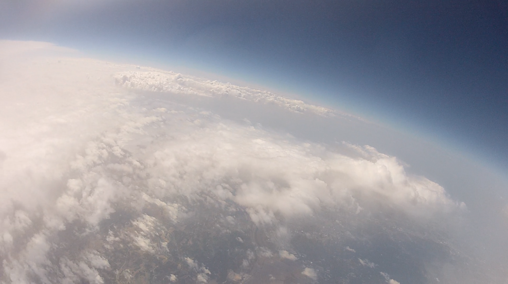
Penetrating the cloud layer with moon
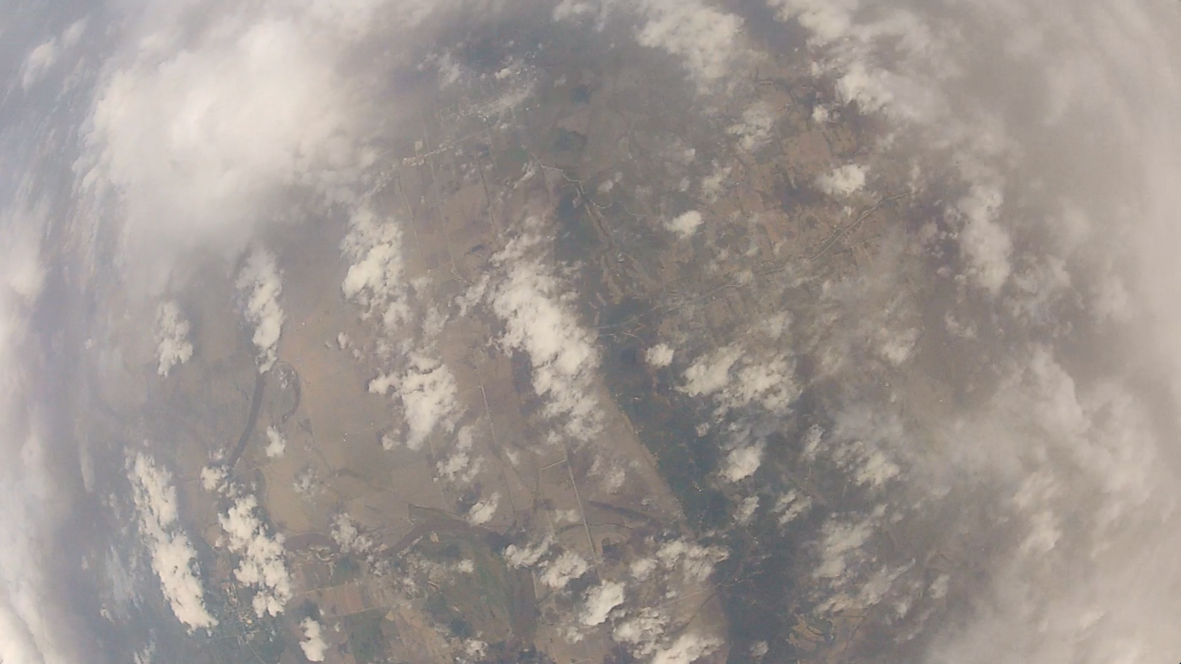
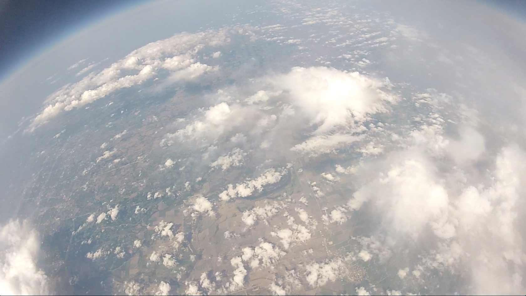
Looking straight down from 75,000 ft.
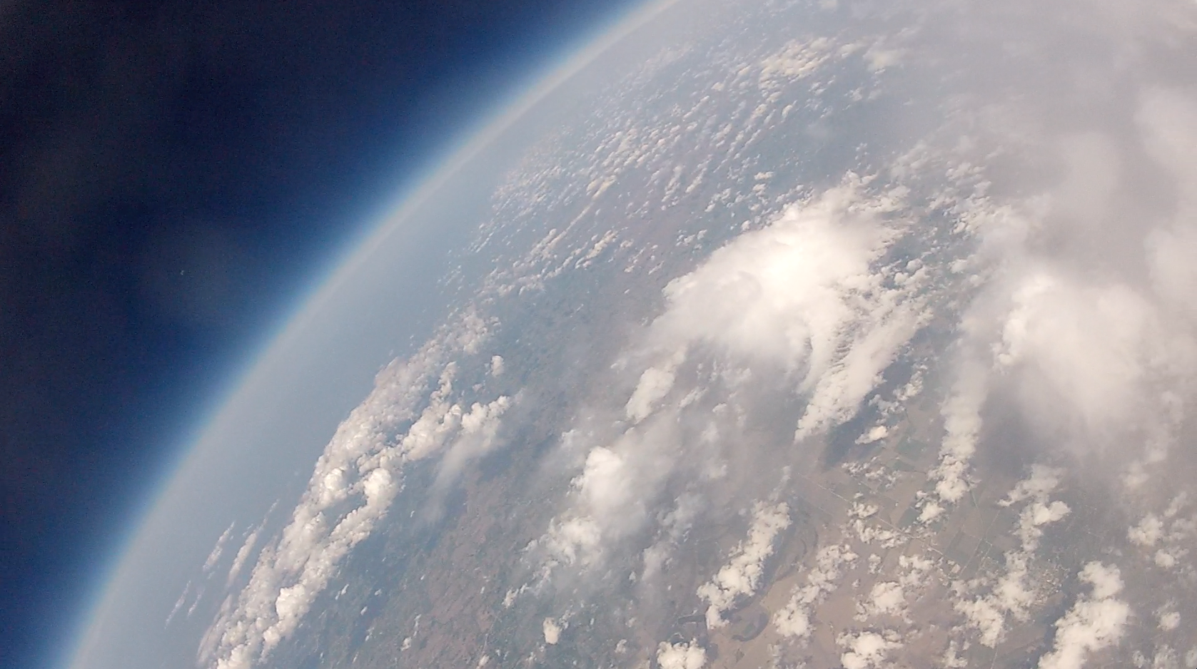
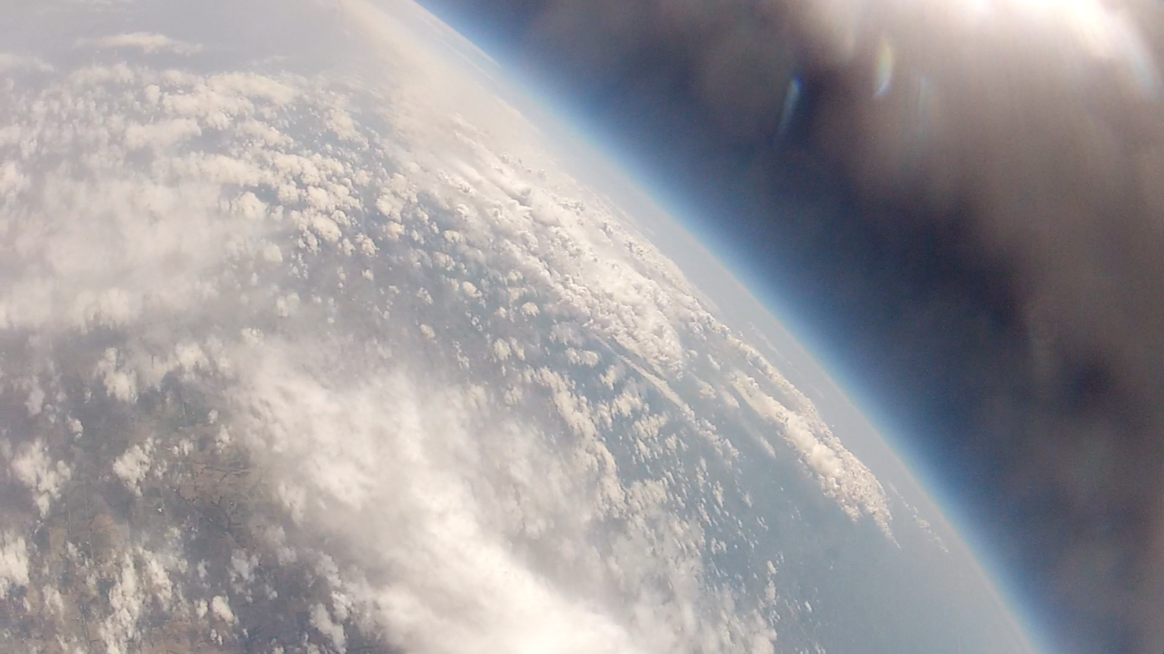
From highest altitude (approximately 89,000 ft.)
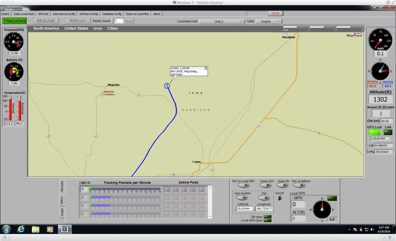
Michael decided to use the new Dashboard software to take the data. This was given to us in beta version through StratoStar and uses LabVIEW for its display. It makes for a much nicer experience seeing the measurements for temperature and pressure rather than the raw values. He had some issues with using a GPS module to show where the chase vehicle was in relation to the balloon on the map that caused some interference errors with the computer during setup. Once the module was unplugged, the program worked fine.
At the same time he was launching, I had a meeting at the Peter Kiewit Institute, the engineering building at the University of Nebraska at Omaha, to brainstorm ideas for a high-altitude ballooning collaboration with them for next year. Their project is called HALON (High Altitude Learning Over Nebraska) and it will use their Advanced Computer Modeling and Virtual Environments Laboratory. They plan to take live data during a balloon launch and their students will transmit that information during a NASA-sponsored Simulation Exploration Experience in April of 2015.
Because there was a live flight in progress, it allowed us to experience the launch vicariously through aprs.fi in the conference room and this gave us an idea of how it will feel to be in the mission control center. One puzzling thing that happened with the APRS signal is that there was a glitch with the altitude measurement and it appeared that the balloon was stuck around 52,000 feet for about a half an hour.

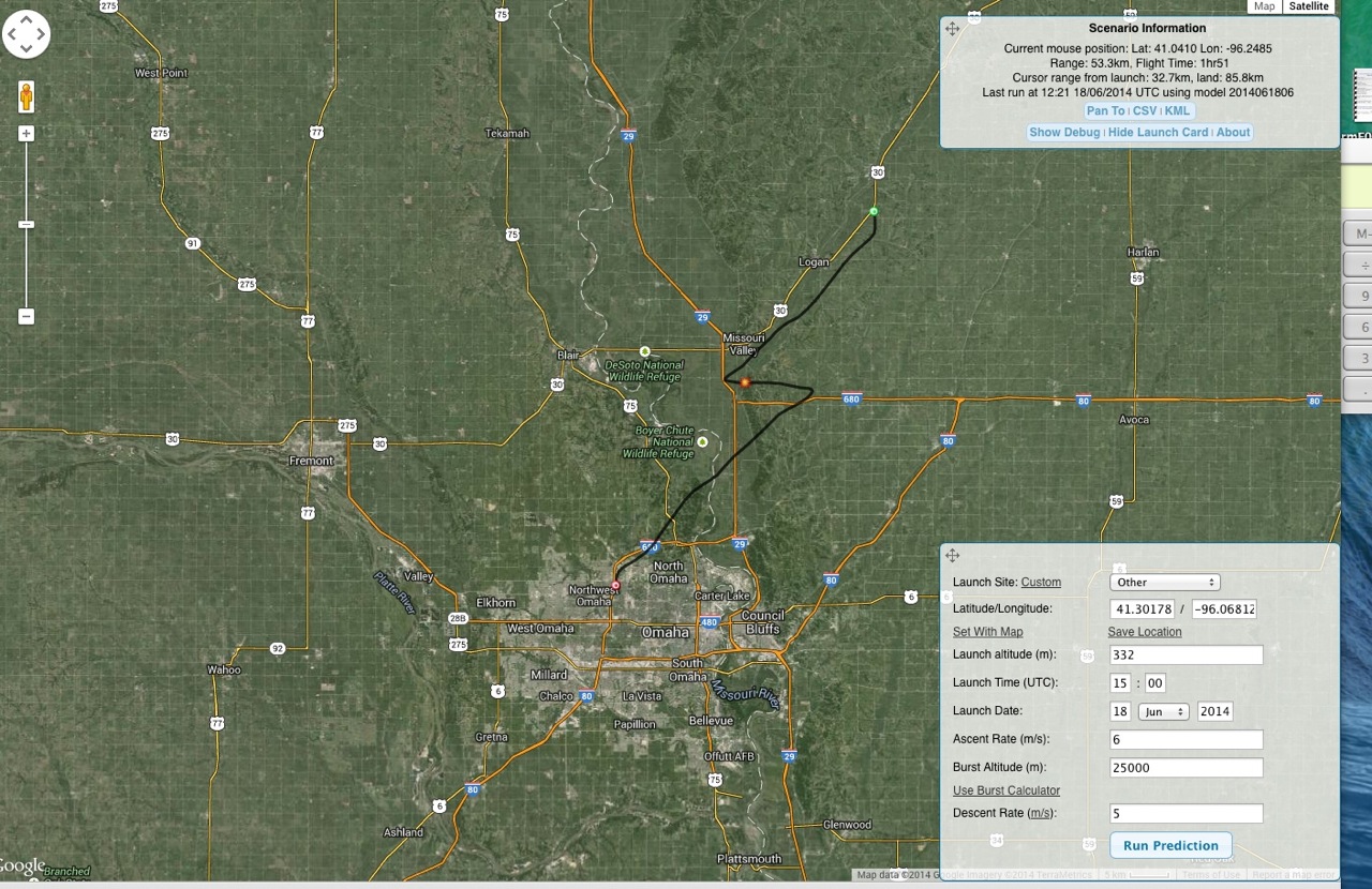
Here is a screenshot of the flight prediction for comparison. It was off a little bit in the middle section. This may be because the balloon went a little higher than expected.
We could see where the balloon landed and on a satellite view, it looked like it might be a challenging recovery.
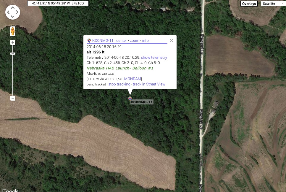
I got a text from Michael that said, “It landed on the top of a very tall tree in the middle of a very wooded area adjacent to a Shih Tzu farm.” I wasn’t sure if that meant that the land was owned by a dog breeder or if autocorrect was to blame for the strange message. It turns out, the former was correct. Go here to see pictures of their cute puppies.
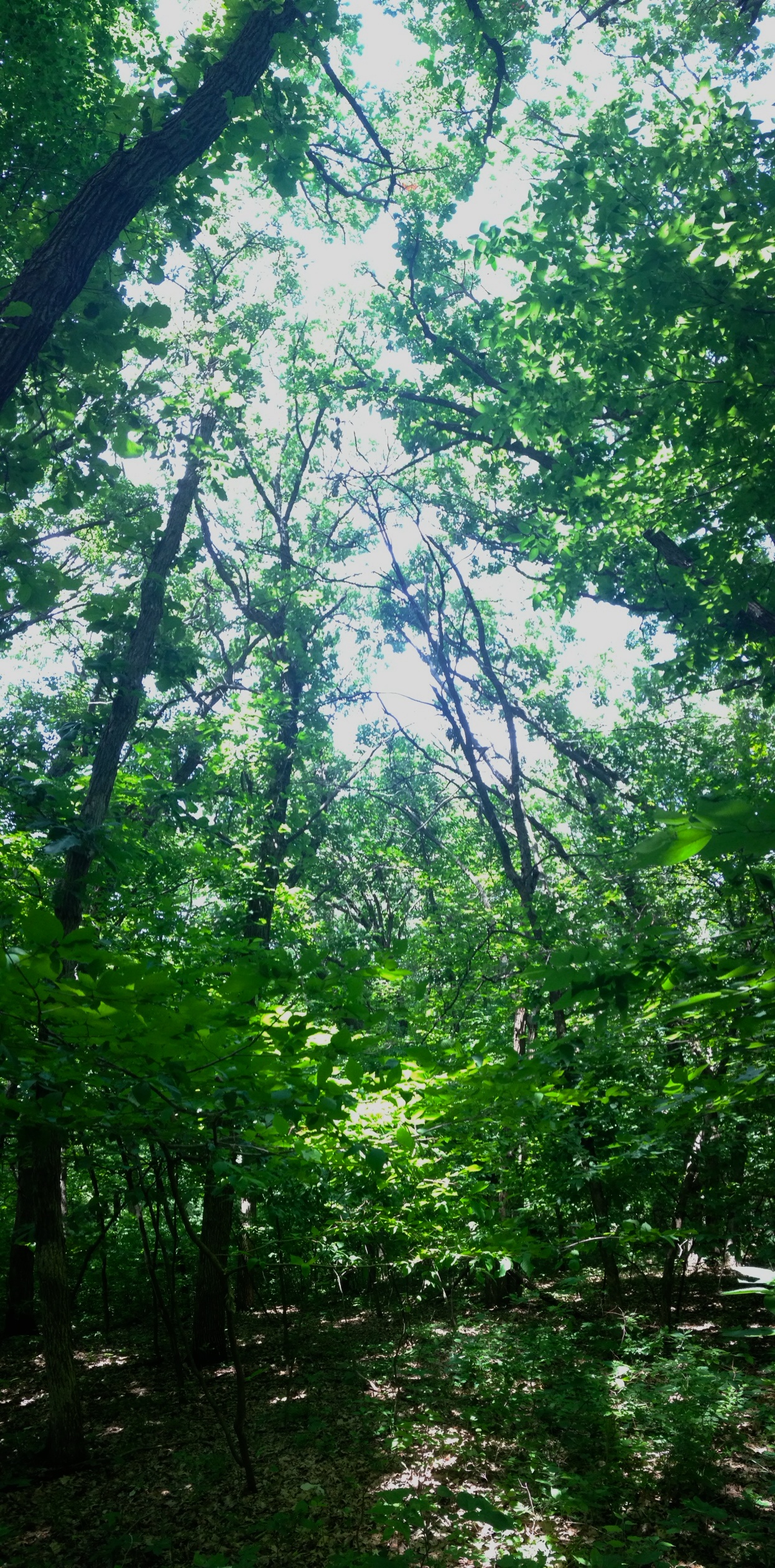
Here is a panorama picture of where it landed. Can you see the orange pod in the middle of the top of the tree?
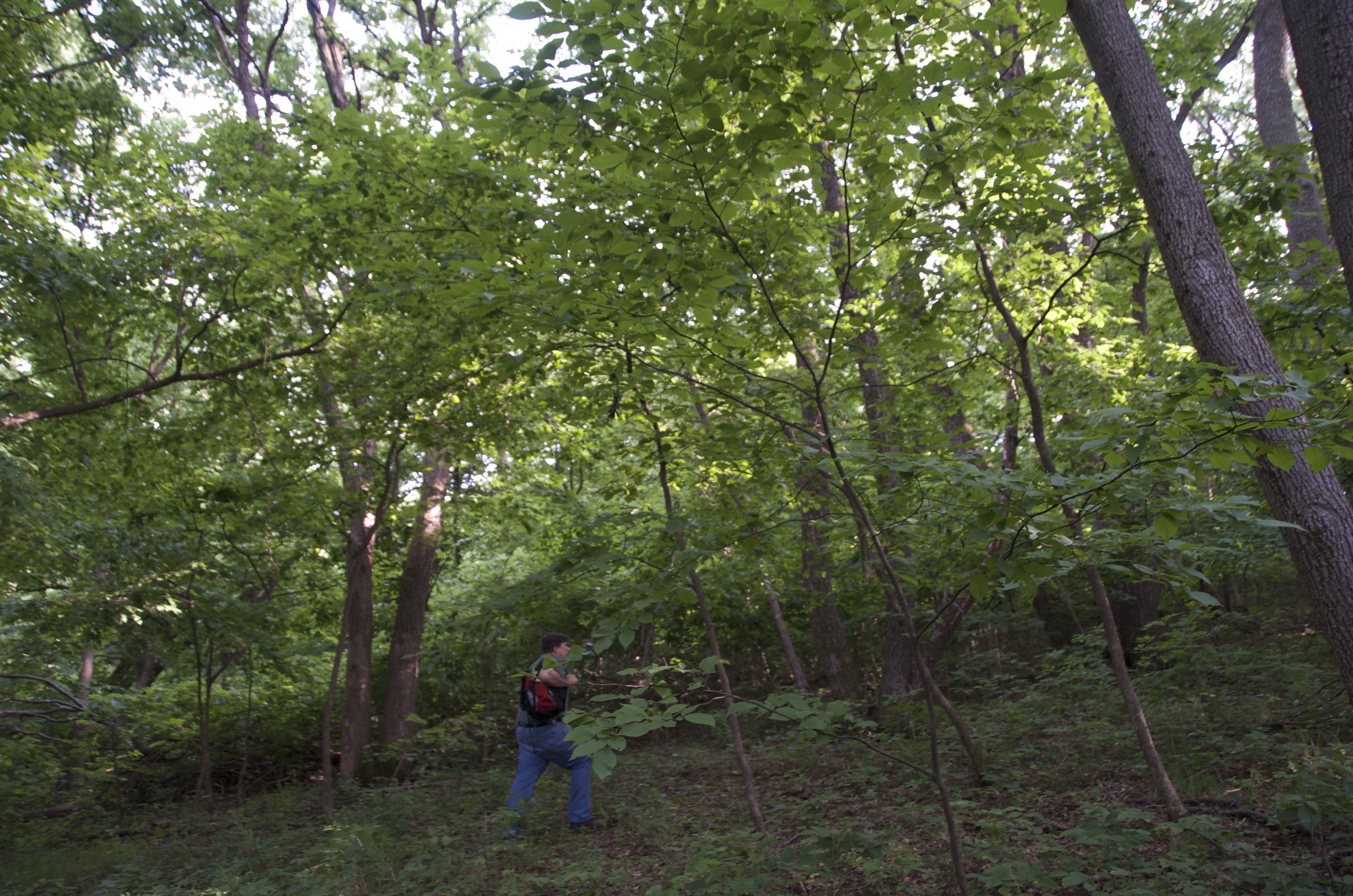
After 36 launches, this was the first one that landed in a tall tree, so I guess we were due. It was in the mid-90s for temperature and very humid in the trees, so Michael decided to take the participating teachers back to Omaha and return to the recovery site later (about 45 miles away). Since he knew where the equipment was and knew that it was not going anywhere, we gathered some tools that might help us and headed back while it was still daylight.
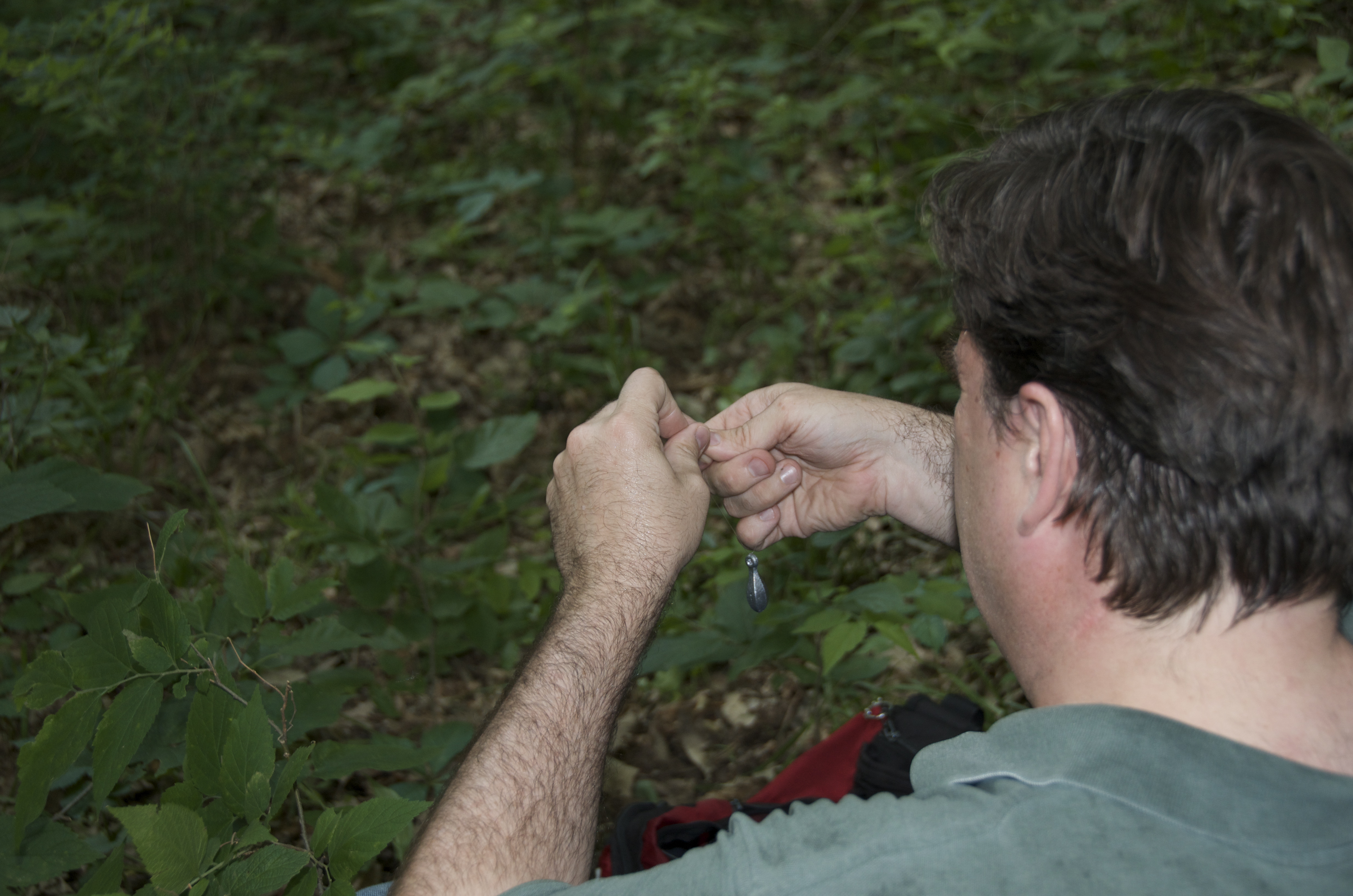
In a backpack, we placed several full water bottles, some lead fishing weights, two spools of monofilament fishing line, three types of string, a slingshot, some baseballs, a weighted tennis ball with metal loop to attach the string, and a child’s bow and arrows. I remembered to bring sunscreen, which wasn’t needed in the woods, but I forgot to grab the insect repellent, which would have been useful as there were a lot of mosquitoes.
We had to hike 0.16 miles up the hill into the woods.
From the measurements on the command module and the hand-held GPS on the ground, we ascertained that it was 44 ft. above us.
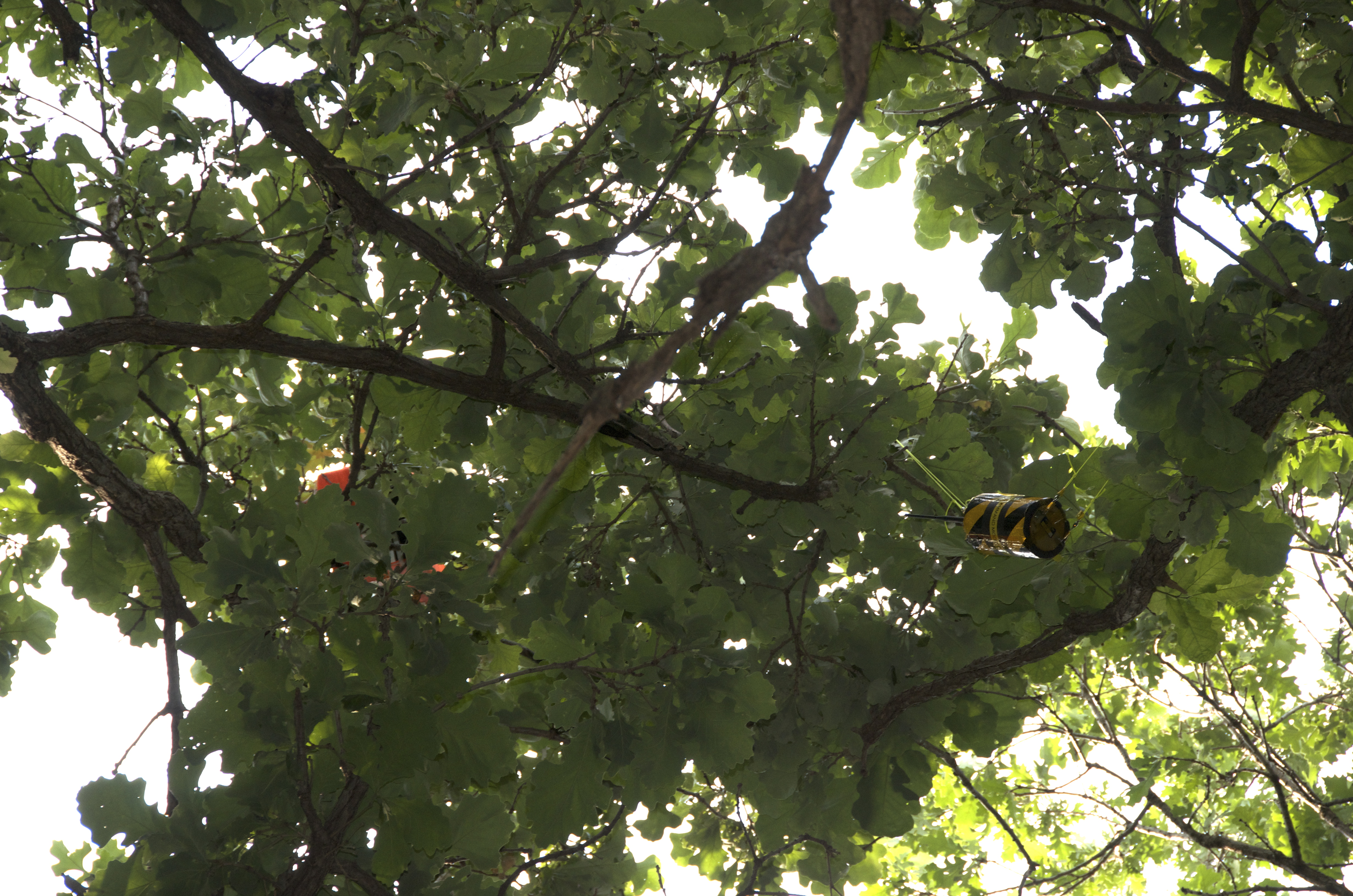
Yup, that’s pretty high.
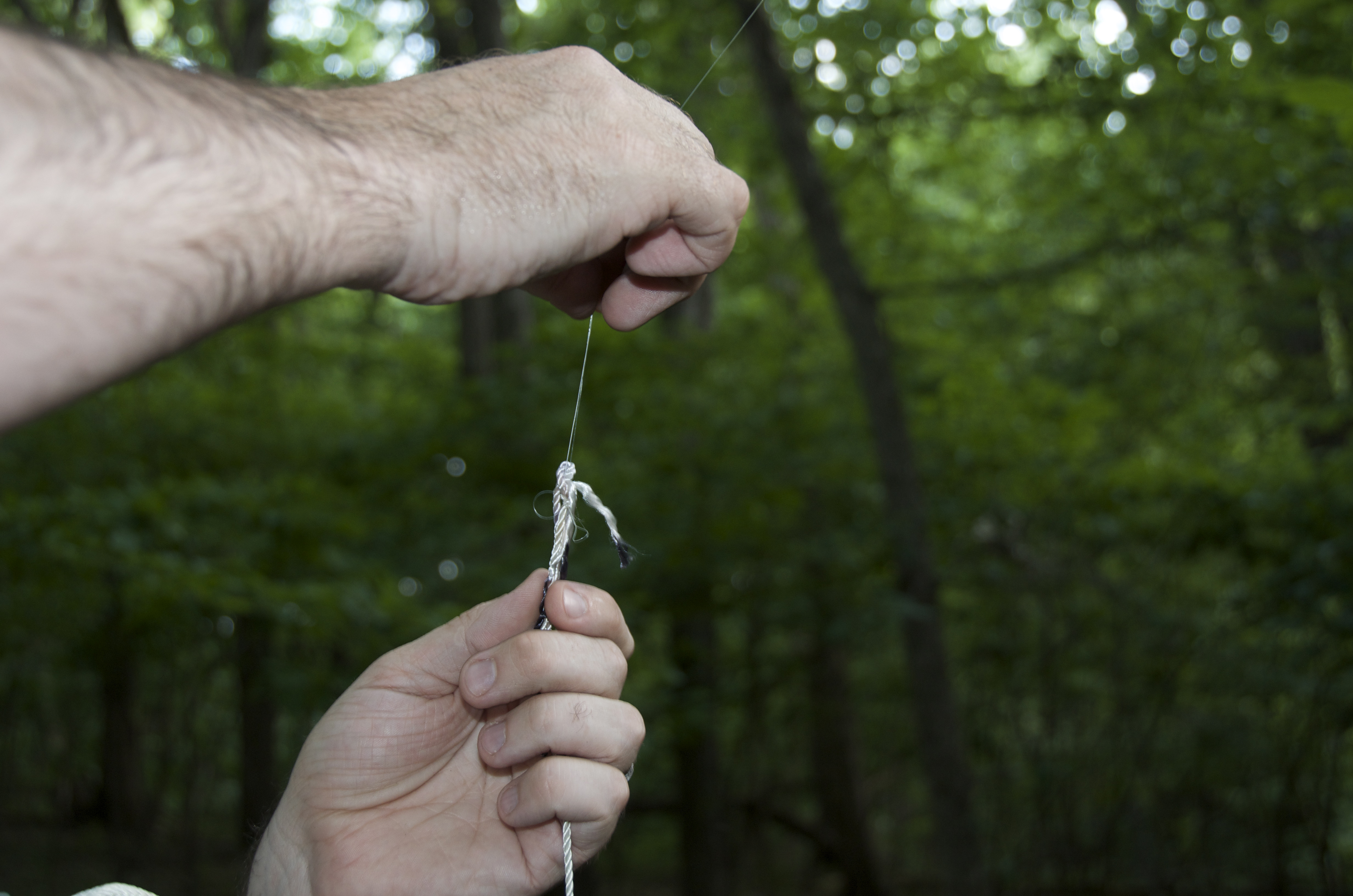
The first attempt was using the lead weights on fishing line and the slingshot to try to shoot it over the branch. When it dropped down, we tied string to it and threaded it back so we could pull the string and try to dislodge the equipment from the branch.
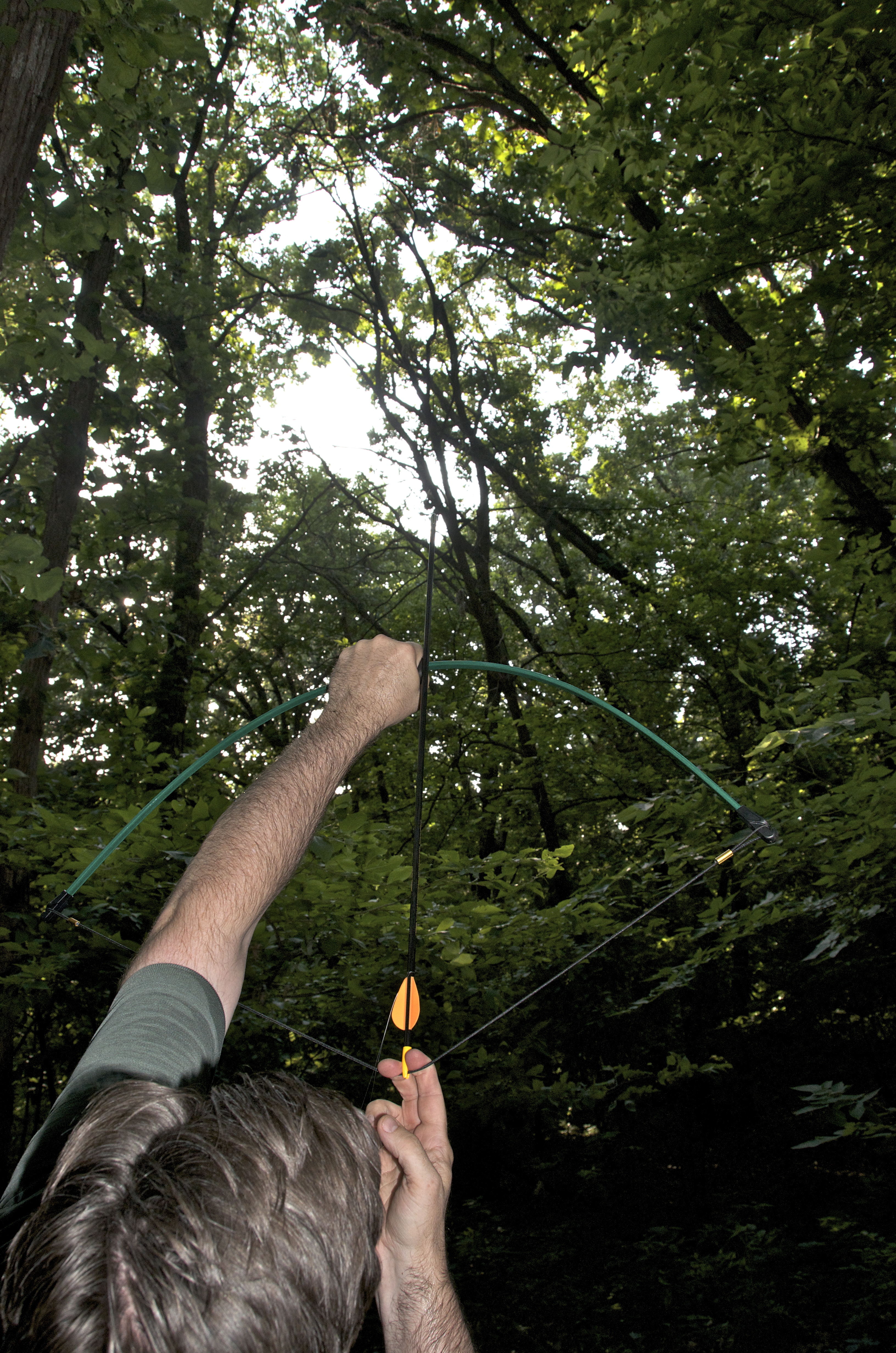
This was adequate, but it was not easy to aim and hit just the right branch. So, we moved on to the bow and arrow technique. Michael, having experience in archery when he was younger, found this to be a much more accurate option.
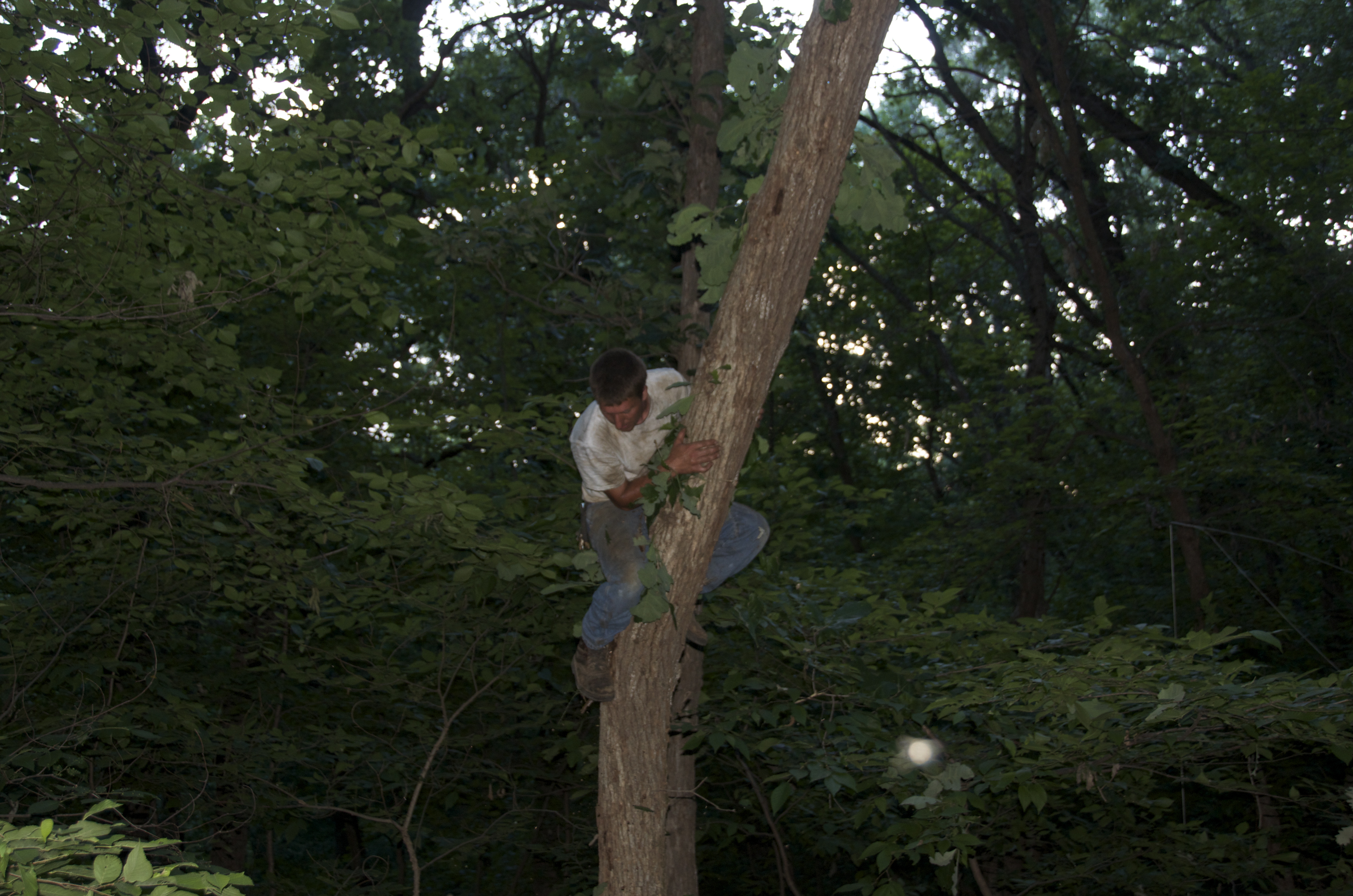
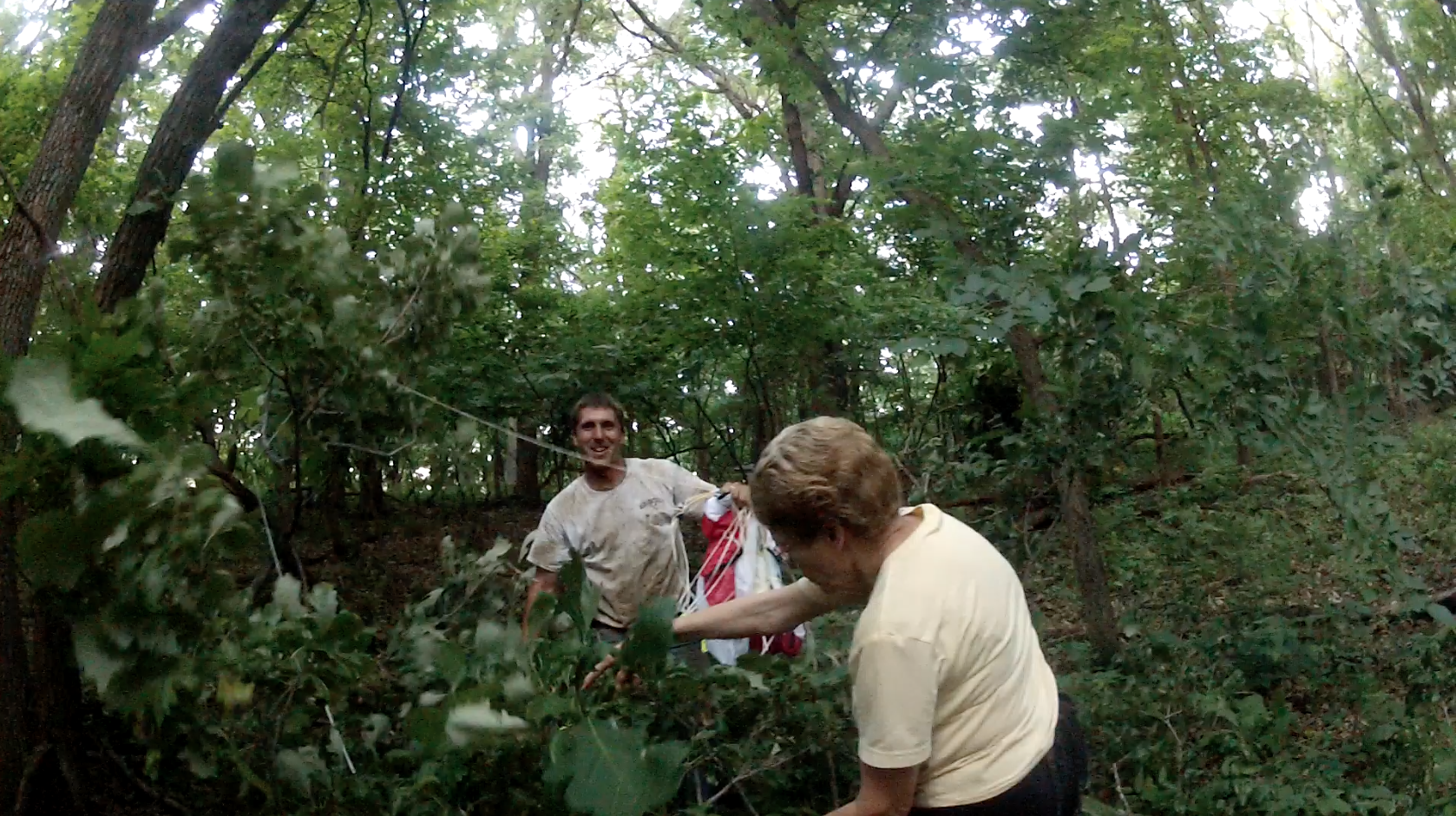
This seemed to be a good technique, but the woman who owned the house where we parked asked her son if he could help. He decided to shimmy up the tree and cut the branch down.

Here is a short video (42 sec.) of the branch coming down.
Our heroes! (Photo taken from the camera pod.) Many thanks again to Ladena and Christopher.
This was so interesting. Thanks for keeping me up to date on all of these.